View our Pigeon Forge map to see the parkway, main roads, red lights and numbers, public restrooms, and more. You can also download our map of Pigeon Forge, TN by clicking the link directly below the map.
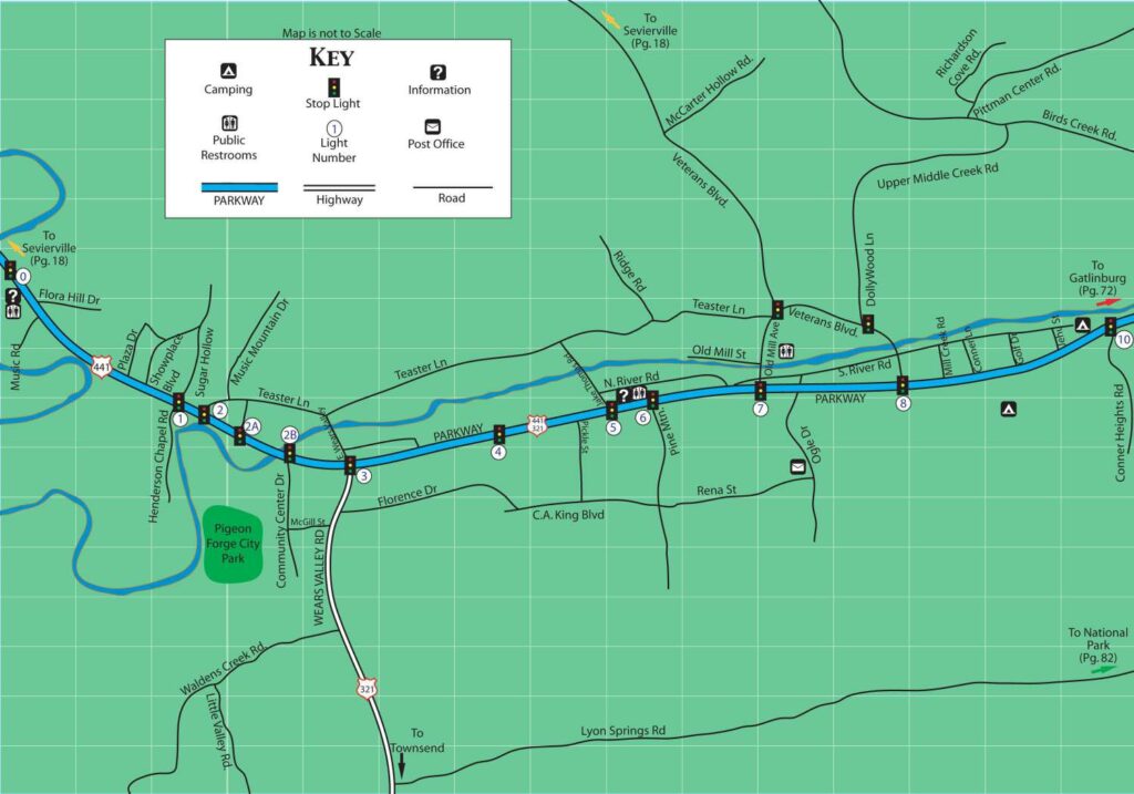
Click Here for Printer Friendly Version, High Resolution PDF Format Size
Pigeon Forge is a town located in Sevier County, Tennessee, nestled in the foothills of the Great Smoky Mountains. The town is primarily connected by two main roads: Parkway (US-441) and the Spur (US-321).
Parkway is the main strip running through Pigeon Forge and is lined with numerous restaurants, shops, outlet malls, attractions, and entertainment venues. The Parkway is the primary thoroughfare for visitors to navigate through the town and offers access to various points of interest.
The Pigeon Forge Spur, also known as “the Spur,” is a scenic route connecting Pigeon Forge to Gatlinburg. It provides a scenic drive through the mountains with beautiful views and is a popular route for visitors traveling between the two towns.
Some notable points of interest in Pigeon Forge include Dollywood, a popular theme park owned by Dolly Parton, and the Smoky Mountain Alpine Coaster, one of the longest alpine coasters in the United States. The town is also home to numerous dinner theaters, miniature golf courses, go-kart tracks, and attractions centered around music, magic, and comedy.
The Great Smoky Mountains National Park is located nearby, offering incredible scenic views, hiking trails, and opportunities for outdoor activities like camping, fishing, and wildlife viewing.
Page Summary: Map of Pigeon Forge, Tennessee with High-Resolution download.